

New technologies have entered the topography sector. On the market, there are so many innovations that making a choice is complex. However, professionals agree to identify a number of tools based on objective criteria. Here is the list of the best topography software.
1- Survey office Spectra Geospatial
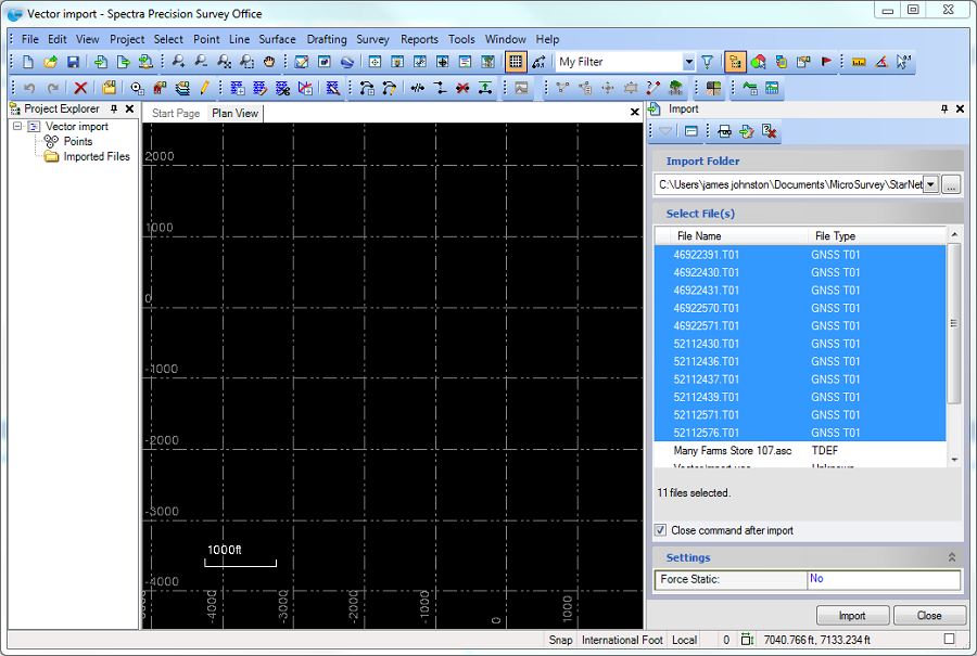
Topography is a sensitive sector that deserves a helping hand. Application and software developers have understood this. For this, they have launched wide ranges of surveying software and products in free competition. Survey Office Spectra Geospatial is one of the benchmarks in the sector. It allows you to perform all the operations in one to obtain a convincing result. It is a great companion for the professional surveyor who prefers to work seated at his desk. He won’t need anything else to finalize his plans. Once he has the data, the software lets him control the recording and management.
In practice, the interface is attractive, allowing you to work on a 3D image database. This is a first point for the tool. Apart from this parameter, the administration project of all operations is operational and dynamic. With great ease, the topographer can make his creations after inserting the data. He also has the possibility of finalizing the projects while including the point clouds as he wishes. Surfaces and volumes pass for fluid data in his hands.
2- Super GeoGPS

This tool is multidisciplinary. It is suitable for the topography professional as well as for the land title, urban planning, geodesy or cartography professional. This expands the range of options offered by designers. In terms of ease of use, the languages were selected according to the countries carrying out the project. Thus, there are French, English, Spanish, Portuguese-speaking and Arabic versions. The most attractive thing overall remains the availability of the tool in paid and free mode at the same time, even if the free version is less advanced than the paid one.
Super GeoGPS is a GPS application for Android, so preferably for the phone, but it can also be counted among the topography software. It is a question of providing the passionate traveler with a tool for referencing and providing in-depth knowledge in orientation. It is for the topographer the opportunity to take data readings with simplicity and to check if his devices have not missed a detail. His mission is then to search the areas normally inaccessible with minimal equipment, his android phone equipped with the software.
3- Caltop
Surveying is all about collecting data, storing it and managing it efficiently. All this goes through a process quite complex enough that a beginner could not follow. It is then a good idea to recommend a tool specifically made to rigorously rationalize the slightest management of topographic data.
The use of Caltop is already simplified by the presentation of the menu. You’ll think you’re in an arcade game. The manipulation is done either by the mouse or by the keyboard. You are entitled to choose the most recent version. With it, the work will be faster and less restrictive. Remember, this is a free tool. So you manage to save money with it. The problem is at the level of linguistic ergonomics. In fact, the software can only be used by a French speaker. However, all those who have experienced it speak highly of it. For them, intuition is the basis of its exploitation. You just have to want to start a process and it’s done.
Read also: 6 best file compression/decompression software
4- DPTopo
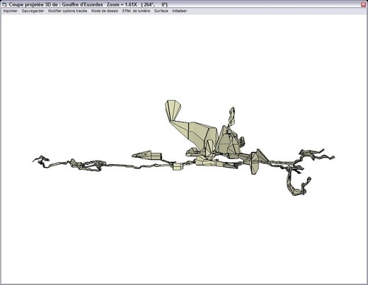
The topographer is sometimes limited in his work by nature and by fear of danger. It is to compensate for this handicap that we design topography software and advanced tools. DPTopo is one. It adapts to a particular branch of topography. For underground topography junkies, this is it. You are able to distinguish shades underground and have exceptional representation accuracy. You become a more efficient professional.
First of all, DPTopo is free. For the amount of performance this achieves, this is a bargain for the professional. Then, the French language is put forward. This is not at all an obstacle to its use for non-French speakers. You just need to know the keywords of the sector and you will orient yourself according to your intuition. Finally, the operations are precise and numerous. For starters, you can make underground topography maps considering field data with ease. In addition, you have the hand to exploit the intuitive character just by recording the data and letting the application design the drawing for you. The cavities are even ordered and faithfully represented.
5- Draftsight
In paid and free versions, Draftsight presents the user with the perfect prototype of the topographer’s tool. Just visit its interface to get an overview of all the work that can be done. Already, you are invited to perfect your mastery of the drawing creation tools. In fact, the software works on the basis of managing 3D or 2D images. For clarification, it is the 2D version that is free. 3D is paid. However, before switching to the use of 2D, it is imperative to register.
With such a tool, you enter directly into the circle of professionals. However, you may need some help getting started. The plurality of data on the menu might actually confuse you. But, with a little practice, you will become a master of the game and everything will be easier.
6- Mensura Genius
It is a paid tool that requires a quick start. It was designed to allow the topographer to work in complete peace of mind. Creation of Geomensura, Mensura Genius counts for a lot in the practical work carried out in the sector since its advent. It is more precise, more comprehensive and more practical than most surveying software on the market. It is a tool ahead of the other solutions in the range offered. It deserves its place in this list.
Having to accompany the professional in the field, he facilitates the inclusion of data in the database. Then, he helps him to design a representation of the project in drawing. Finally, he participates in the design of the model. All this is done in 3D. This adds to its attractiveness. Apart from these notorious elements, it should be noted that the interface is unique in its kind, adapting the computer-assisted drawing device. Even civil engineering and sanitation professionals use the tool to carry out their mission.