
Google Earth appears as the unstoppable leader when it comes to visualization platforms. With this application, you can access a multitude of virtual representations of the earth in three dimensions. You can also explore natural landscapes and man-made cities. But, there are excellent alternatives to Google Earth, here we suggest you discover the best services like Google Earth.
What is the difference between Google Earth and Google Maps?
Google Maps is an online mapping service that provides interactive maps and navigation information to help users find addresses, businesses, and other points of interest. Google Earth is Earth visualization software that offers satellite images, 3D images, and 3D views of buildings and landscapes. Generally speaking, Google Maps is primarily designed for navigation and orientation, while Google Earth is designed for discovery and exploration.
Google Earth: what does this expression mean to you?
Do you want to import vector data, images, or spreadsheets in multiple formats? So, all you have to do is download Google Earth. The latter simply designates a Geographic Information System (GIS). It is a true virtual atlas in a 3D format created since 2001. With its free pro version and even available under Windows, this application offers you the possibility of visiting planet Earth in all its splendor. You can also visit the moon, the sky, and many other planets in all their colors with the possibility of recording images and videos. Google Earth also lets you live up to the perfect custom map creations. Google Earth is the surest way to contemplate the earth as well as the stars in all colors. It’s simply the best city guide.
What are the best alternatives to Google Earth?
Multiple technological and computer advances have now made it possible to achieve certain things that were once considered impossible. This is the case with the use of superimposed images from satellites and Geographical Information Systems like many other things. In any case, whatever your project relates to space, you can count on the best alternatives to Google Earth. Zooming in on buildings as well as cities and natural landscapes is now easy with:
1- NASA World Wind
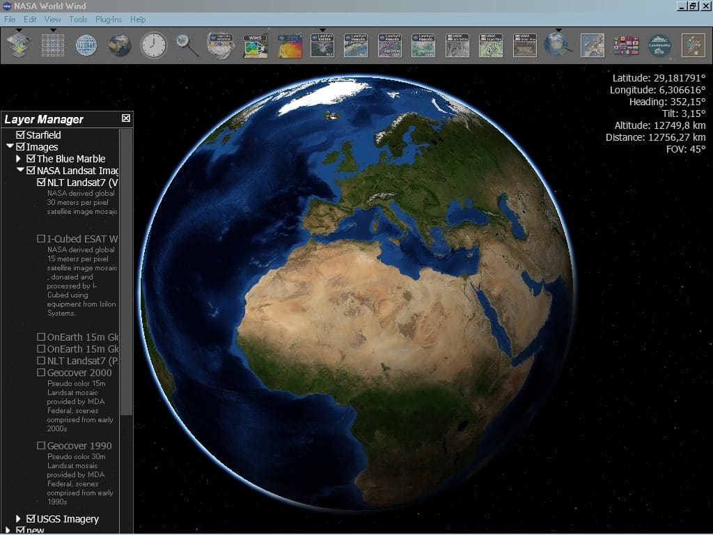
An application that is sponsored by the US space agency and bears its name is without a doubt a quality application. This is therefore the case of NASA World Wind, an open-source program that is definitely one of the best alternatives to Google Earth and unquestionably represents one of the best in the world when it comes to mastering space. You should know that this application is a software development kit with Java as its base.
NASA World Wind was primarily designed for developers. They can indeed use it to develop programs using data from NASA or the USGS. These can be topographic maps or satellite images. A multitude of controls is offered by NASA World Wind, ranging from zoom to tilt. In addition, millions of political boundaries, place names, as well as lines of latitude or longitude, are included in the database.
What you still need to know about NASA World Wind is that a lot of plug-ins and add-ons are associated with it. You will then be able to use it to complete the functionalities of the application. For example, you can add camera control scripts. Similarly, some plug-ins and add-ons allow you to add XML files that show position marks as icons.
Finally, remember that NASA World Wind, which you can download for free, is compatible with all common operating systems. Whether your device is running Windows, Mac OS, or Linux, you can download NASA World Wind, install it and use it.
2- Marble
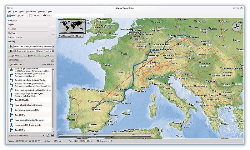
Marble is another very good free alternative to Google Earth. The application allows you to have access to all corners of the earth’s globe. This is an alternative solution that provides you with a large number of viewing modes. Thus, with Marble, you will be able to visit the planet Earth as a 3D globe. You will also have the opportunity to take a look at its topographical features. Marble also gives you the ability to access views of streets around the world. Do you want to know more about temperature data related to a specific location? It is possible with Marble. Likewise, if you’re planning to travel to a part of the globe, but are worried about falling in a rush, you can find out more with Marble.
This highly capable application puts a multitude of photos at the fingertips of its users as well as regular traffic updates. As these updates are done in real-time, you can count on Marbre to get an accurate idea of road traffic at any given time. With Marble, you will therefore be sure not to get stuck in traffic. As a result, you will have an accurate idea of road traffic in real-time and you can quickly know the least congested detours to take to reach your destination.
Remember that Marble also provides you with an online and offline address search functionality. This is therefore very convenient since you can use it, even when you are not connected to the internet. One of the great strengths of Marble is the fact that its designers have equipped it with routing and navigation features that can be used both online and offline.
Don’t worry about having to free up a lot of memory space on your computer before you can install Marble. Indeed, this application does not weigh very much, since its delivery is done without adding data sets. Of course, if you want to take advantage of these additional datasets, you can get them through in-app downloads.
You even have the possibility of having access to a whole panoply of data thanks to which you will be able to see and admire the moon in several virtual models. This possibility is extended to other planets. Some data will also allow you to access the orbits of satellites and space stations. It should be noted that all this data is regularly updated. This means that the information offered to you by Marbre does not suffer from any alteration or obsolescence.
There are still plenty of good reasons to choose Marble over Google Earth. For example, the application provides you with a very useful weather simulation tool. Marble also offers many bookmarks which only help to make it even more efficient.
Finally, note that this application is not only available in a version compatible with the Windows operating system. Marble is also compatible with the other most commonly used systems which are Mac OS, Linux, and Android.
3- Zoom Earth
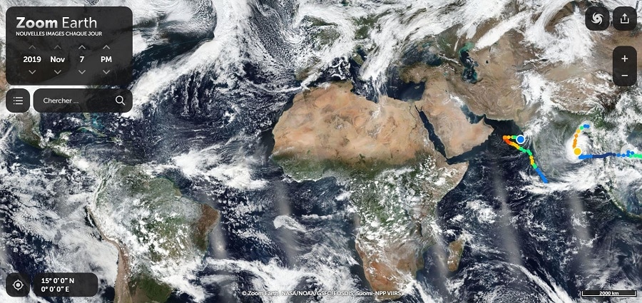
Do you only want to have an application for viewing terrestrial satellite images? In this case, you can settle for Zoom Earth. This alternative to Google Earth, also called Flash Earth, is browser-based and guarantees you access to any corner of the globe. As its name suggests, Zoom Earth is a Flash application available online. You can use it to view satellite images of the Earth, using several sources. The sources most used by Zoom Earth are NASA, Bing maps, and ArcGIS. It is possible to specify a custom date for images provided by the US space agency. Concretely, the specification can relate to a day, a month or a year.
Zoom Earth is also provided with a search functionality through which you can view images relating to any location on the earth. What is even more interesting about the application is that you have the possibility of sharing the images viewed, thanks to direct links!
Zoom Earth allows you to see places closer. You can create maps and stories with videos and images using Zoom Earth. This software also offers you the possibility to create animations. Of interesting flexibility, Zoom Earth allows the visualization, the creation, and especially the facility of edition. It should be noted that this application provides satellite images mainly from NASA satellites. These are regularly updated images.
4-QTViewer
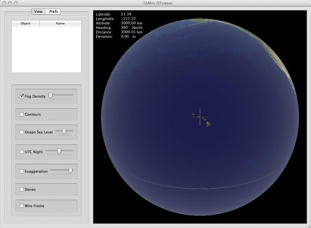
QTViewer is a software that allows you to accurately display all geographic field data in real-time. With a simple and intuitive interface, this alternative to Google Earth uses functions of the libmini viewer, but also offers additional camera control. This application is compatible with many systems such as Windows, Linux, and Mac.
5- Terra Explorer Desktop
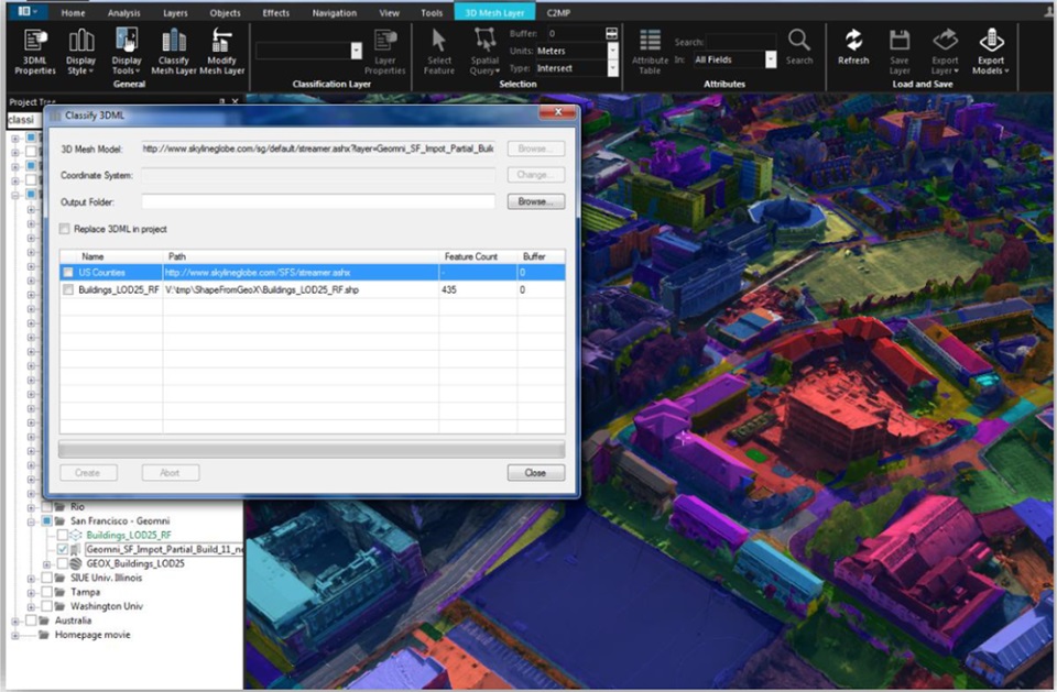
TerraExplorer for desktop is a browser that allows you to view places on the globe in 3D. It is the ideal tool for organizing trips, developing commercial schedules, and monitoring sporting events. Useful for organizing trips in that it allows you to see the landscape in advance and then choose, if you are a tourist Terra Explorer Desktop is a weapon you should not give up.
In the development of commercial schedules, TerraExplorer Desktop allows you to visualize the places where you must sell your product that you may not know. You can therefore easily have a map of a city, Terra Desktop is shown here as a factor in reducing the risk of insecurity. You finally have the facility to project the images on a stadium, this is the usefulness of Terra explorer Desktop in the follow-up of sporting events. Indeed, you have the possibility of viewing the entire French territory in 3D with the TerraExplorer Desktop browser in conjunction with Geoportail.
Precision and flexibility are among their strengths. Three versions or 3 levels of functionality exist: the TerraExplorer viewer, TerraExplorer plus, TerraExplorer pro. This online platform with a size of 120.43 MB allows you to explore a map of the world with version 6.5.
Other options such as 3D video and slideshow creation, analysis, and sharing of high-resolution 3D geospatial data are available to you. TerraExplorer Desktop is characterized by its interoperability, support for any format, its advanced drawing tools, but also the superposition of imagery and elevation, BIM projects, CAD. It is a tool used by developers.
6- Celestia
It is undoubtedly one of the most interesting and complete space simulators. It offers you the best opportunity to explore your planet in 3D. Unlike most planetarium apps, Celestia offers more extensive space exploration. Indeed, it goes beyond the earth’s surface to take you to the depths of the solar system and the galaxy world. Over 1000 stars to visualize using this alternative to Google Earth. It is also functional with Windows, MacOS and Linux systems…
The best alternatives to Google Earth are NASA World Wind, Marble, QTViewer, Celestia, Zoom Earth, and TerraExplorer Desktop. While the first 4 applications must be downloaded and installed before use, the last 2 are directly available on the web. But all 6 are totally free to access and offer features that do not suffer from comparison with those of Google Earth.